The ProjectThe neighborhood of Martin Drive East is very isolated from other neighboring areas because of its location. The community is bound on the northern edge by Vliet Street, a very busy thoroughfare with fast moving traffic. On the southern end, the railroad lines and Harley Davidson Motor Company campus cut this area off from the Concordia neighborhood. The east end is cut off by 35th Street and the railroad corridor while Highland Boulevard that defines the western edge, isolates this neighborhood topographically due to a steep drop in the ground level. The result of this isolation is that Martin Drive East does not share the identity of Martin Drive West and this "residential island" lacks amenities for the people living within that neighborhood. The objective of this project is to create a sense of place for this neighborhood by designing a network of learning and gathering spaces within walking distance from each other. In doing so, this project hopes to produce a vibrant, walkable and self-sustaining community.
According to the Project for Public Places, "The consensus within the field of transportation is that having more people use non-motorized transportation more often is critical to sustainability, economic development, and good public health." The organization explains that "the factors affecting people’s decision to walk, are the types of factors that make a good place: uses & activities, access & linkages, comfort & image, and sociability."
By making walkability a central concern this project attempts to address the real as well as perceived problem of safety that plagues this neighborhood. The many vacant and unused spaces such as empty lots, parking lots, hard scape, and abandoned buildings contribute to this impression. However these undesirable spaces can become assets if we rehabilitate them into learning and gathering areas for the neighborhood. Jeff Speck, city planner and the author of "Walkable City" explains the concept of walkability
|
The pictures below show the current conditions of Martin Drive East. The area is neglected but there is no lack of potential.
The diagram below conceptually organizes the neighborhood into three zones: The front edge that abuts Vliet Street serves as a point of contact with the outside world. The middle area is the residential core that should have a unique sense of place and identity. The back edge borders on the railroad corridor and an industrial campus, creating a dead end. This zone has the potential to become a community zone, a place for neighborhood interaction and communion.
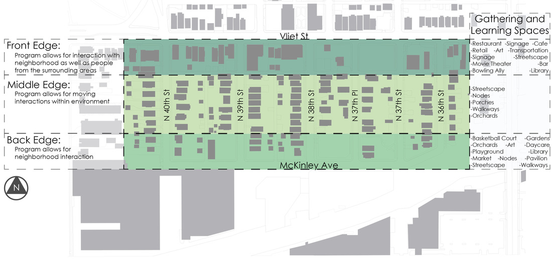
Gathering and Learning Edge Typology
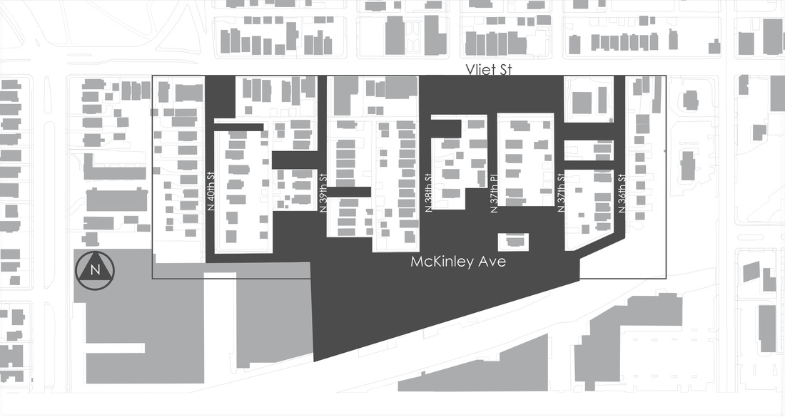
The dark grey spaces on the diagram below represents all of the vacant, unused, and flat spaces within the Martin Drive E neighborhood. These spaces include streets, alleys, parking lots, empty lots, abandoned buildings, and hard scapes.
|
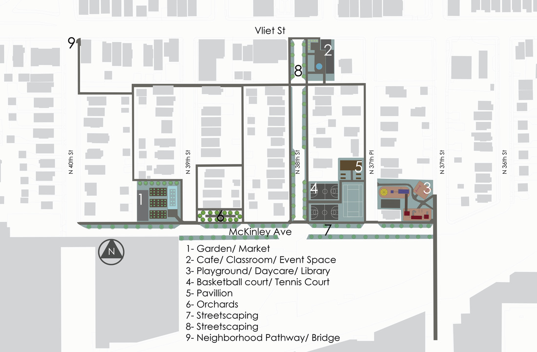
Walkable Neighborhood Plan for Martin Drive East
|
The long term plan for this neighborhood suggests a series of public gathering and learning spaces in the unused and vacant lots. This network of public spaces reinvigorates the neighborhood, bring residents together and makes the neighborhood walkable and self-sustaining. This design plan of the neighborhood may be implemented in phases over the next 20 years based on the expectations and wishes of the residents.
See also: Nodes and spaces of learning and gathering
|
|
|
References:
Diodati, Monica. 'The Better Block'. The Better Block. N.p., 2015. Web. 10 Nov. 2015. Hamdi, Nabeel. Small Change: About The Art Of Practice And The Limits Of Planning In Cities. Routledge, 2015. Print. Jacobs, Jane. The Death And Life Of Great American Cities. Print. Lydon, Mike, Anthony Garcia, and Andres Duany. Tactical Urbanism. Print. Lynch, Kevin. The Image Of The City. Cambridge, Mass.: MIT Press, 1960. Print. Urban Street Design Guide. 2nd ed. New York: Island Press, 2015. Print. |
