Resources of path
Mapping of connectivity and environmental factors affects the design the walkable plan. In this plan a careful approach was taken in the intersection design of West Juneau Avenue and North 37th Street. The creation of a fully accessible and enjoyable path was completed with layering of seating, correct grading and site line planning from the street to the adapted building.
NATCO's Urban Street Design Guide
NATCO's Urban Street Design Guide
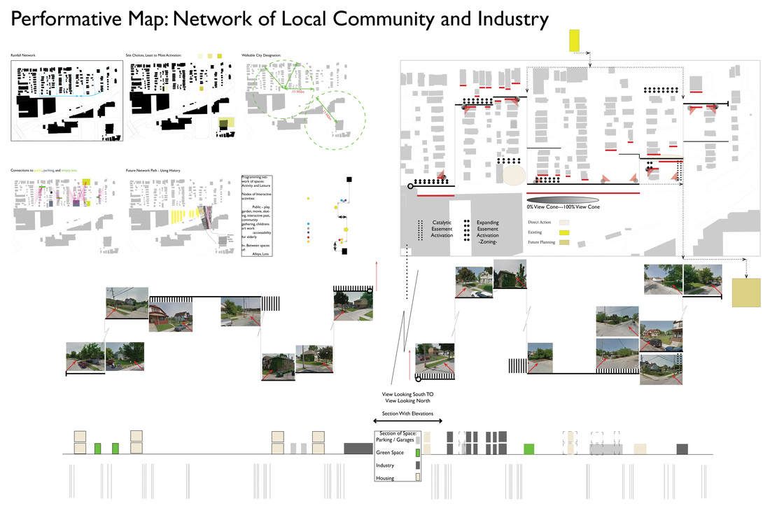
Multiple resources located to the north, south, east and west affect the Martin Drive East area. These resources such as Washington Park are further interconnected with a walkable city plan above. Activities that take place in these empty lots, alleys, and existing pathways are interconnected for use by the immediate community. Some activities include gardening and play spaces for the community. Larger nodal spaces are used as destination points along the walkable path for everyone to use. A pedestrian bridge from the early 20th century is also reintroduced. This is used to bridge the gap between the industrial and southern residential portion of the Martin Drive Neighborhood.
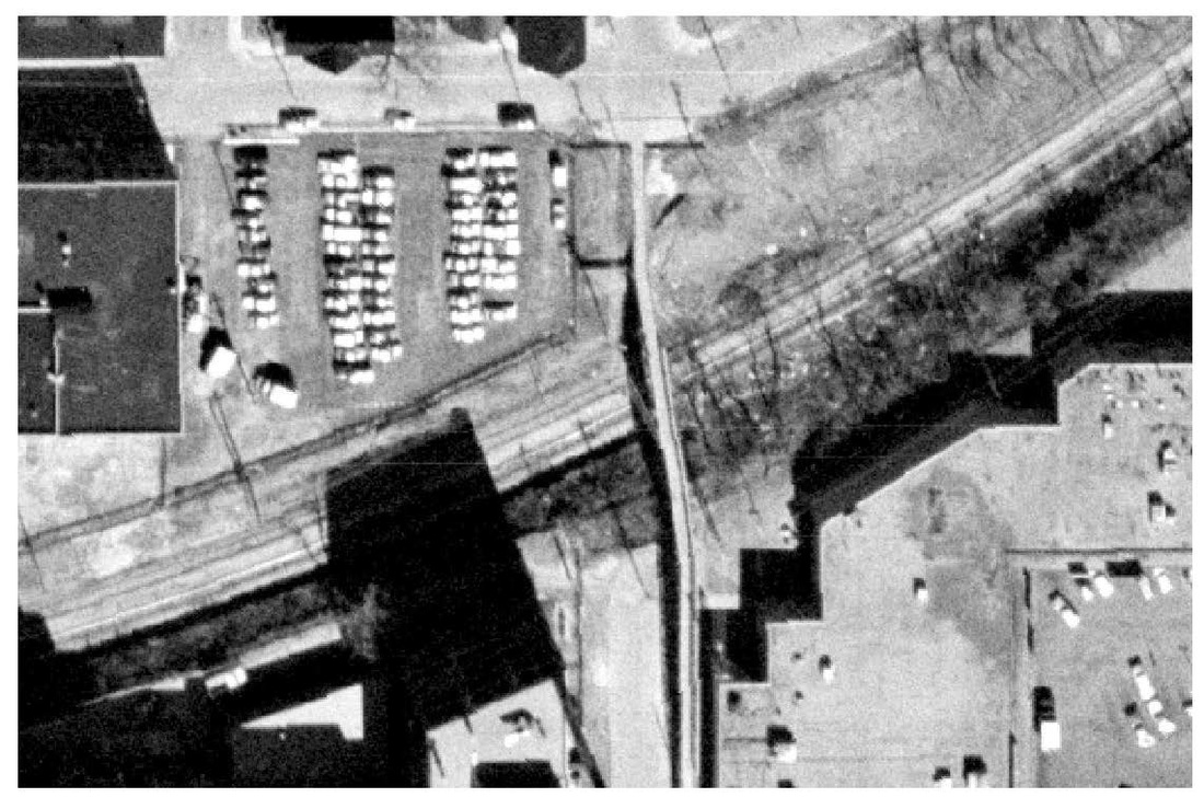
Original pedestrian bridge spanning the 30th street corridor: gOMilwaukee, Milwaukee County Aerial Image
|
Walkable path views and experiences.
|
